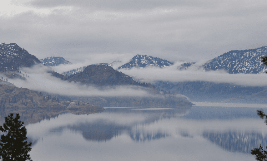
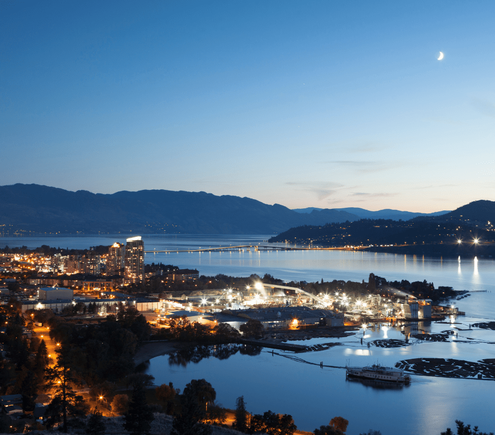
The Okanagan Water Basin is deemed a region of interest by the federal government as it straddles the Canada-U.S. border, and is marveled by hydrologists as a living laboratory that includes one of two deserts in Canada.
It also has one of the highest numbers of species at risk.
Due to eutrophication of mainstem lakes in the mid-60’s, the Canadian government conducted the Okanagan Basin study (1974), one of the largest federally funded limnology (freshwater science) studies ever conducted in Canada. Being a relatively small area of 8,200 km², the Okanagan watershed supports residents, agriculture, forestry, fisheries, and tourism resulting in the need for many special interest groups to work together to protect and preserve the flow of clean water through this unique valley.
In the 1960s, the Okanagan had water pollution problems from poorly treated sewage effluent, runoff from cattle yards, and organo-phosphate/lead-arsenate insecticides that created algae blooms and toxic conditions in Okanagan Lake. This also led to the establishment of the Okanagan Basin Water Board (OBWB) in 1970, which is a valley-wide partnership between the three regional local governments to identify and resolve critical water issues in the Okanagan watershed. One of the earliest programs of the OBWB was its sewage facility grant program, supporting local governments to upgrade areas on septic to community sewer, and purchase state-of-the art wastewater treatment facilities.
Municipalities stepped up to the plate and upgraded their wastewater treatment plants at an impressive pace. Within 20 years, the level of phosphates in the lake dropped by more than 90%. The federal government expanded water monitoring in the basin to include 160 hydrometric stations. These stations were installed, in part, to address the 1974 Okanagan Basin Study recommendations and anticipated increased local water demands.
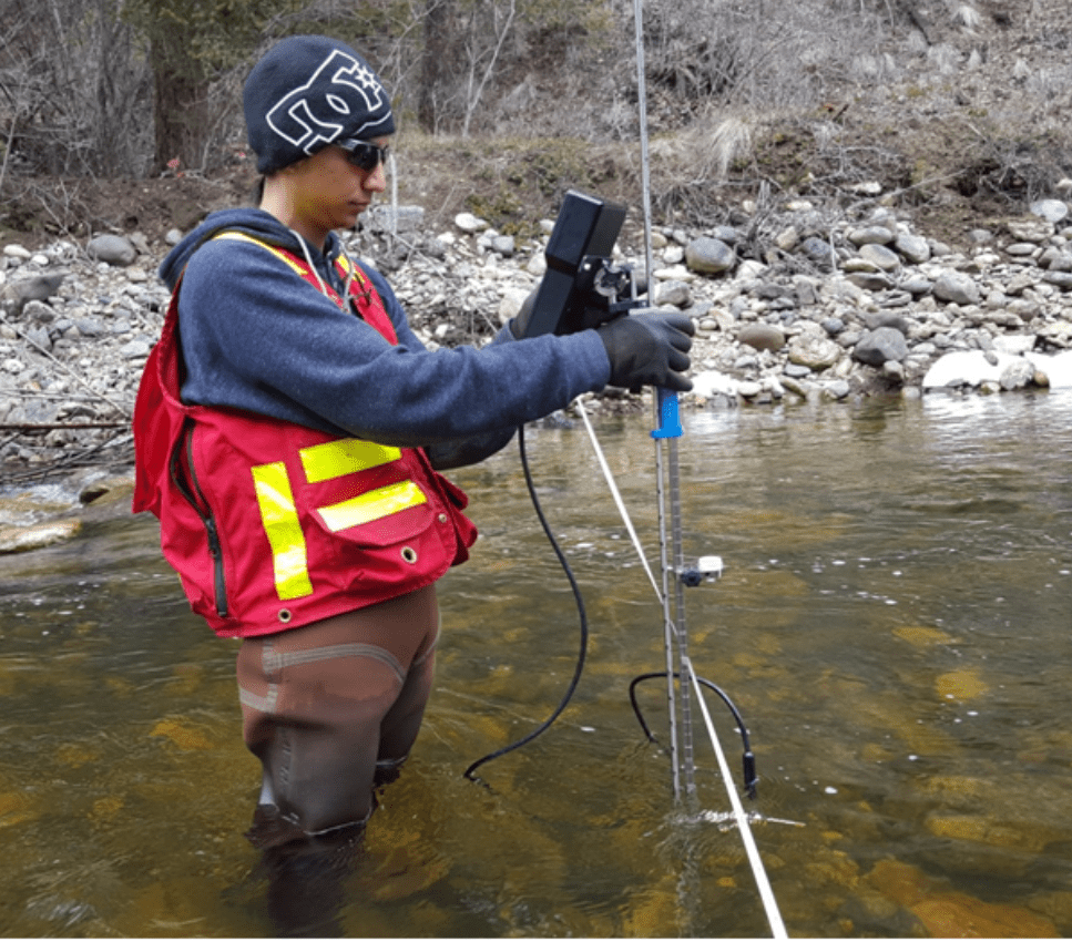
Today, however, there are only 23 Environment Canada operated hydrometric stations left in the watershed and OBWB is working with partners to bring that number back up as climate change is impacting the area. In 2021, the OBWB started a hydrology monitoring program to fill in the gaps.
The sooner we can get more data on the long-term trends of systems, the better equipped we are to deal with climate change and longterm management of our water system.
2021 OBWB implemented a new hydrometric program with a mandate to work with partners and establish new hydrometric stations that would, in part, support the development of environmental flow data, and support new hydrology models. To manage this data OBWB uses Aquarius software to acquire, process, model and publish water information in real time. Jatel said, “I refer to Aquarius as the “Microsoft of hydrometric data.” It is used by Environment Canada, USGS and other water monitoring agencies, so data sharing and integration are seamless.”
OBWB has data coming in from partner agencies and publicly available sources, and they also collect their own Class 2 data – the highest quality data not collected by Environment and Climate Change government staff. Aquarius enables OBWB to centralize this vast amount of hydrologic time series data, discrete measurement data, and complex river gauging measurements from various locations.
With reliable data, OBWB is expanding the mapping of floodplains to include flood hazard mapping and shares this information through its Okanagan Flood Story website and flood portal, as well as social media channels. Using historic and current data, stakeholders have access to knowledge that can play a role in zoning, planning for infrastructure, or helping residents choose where to build or buy a house. It also gives residents strategies to reduce the risks of flooding and tips for floodproofing.
Sharing data from Aquarius gives our data a QA/QC stamp of credibility that allows smaller organizations like us to punch above our weight when it comes to delivering reliable and trustworthy data with the big players like Environment Canada

Ensuring all stakeholders have up-to-date, relevant information allows communities to plan for the future and respond to problems with water systems. Another program that OBWB has initiated is the BC Water Use Reporting Centre. “This started as a local initiative to get municipalities to record water usage monthly rather than annually, but we soon realized this tool would be valuable to all water managers and has been voluntarily adopted in several communities throughout the province,” said Jatel. “The increase to monthly usage reporting has made a meaningful impact on the granularity of data, reporting monthly instead of annual use data, and is enabling participating B.C. water license holders to monitor water-use patterns so they can modify consumption and fix aging infrastructure before it becomes critical.”
An online portal makes it easy for participants to access and input their data, and it streamlines management for the province with automated processing and secure storage of data in one platform. This voluntary water use reporting software also adds a level of transparency to water consumption that can motivate better practices.
Jatel said, “Hydrometric data is at the heart of water management. Collecting, managing, and making this data transparent are all important steps to ensure the data may be used to support actionable insights into our changing water patterns for our partners and programs, and is an important OBWB service. By gathering high quality hydrometric data and sharing insights resulting from data-dependent hydrology models, we can find practical solutions to protect our water, and the social-ecological systems that depend on it.”