

The Solution: AQUARIUS
The City implemented AQUARIUS to manage their data and publish information to all stakeholders. By connecting to sensors in real time, the software automatically imports and integrates data, giving operators a continuous stream of central intelligence without manual input. The platform keeps permanent records of original data and data quality is tracked with qualifiers and quality grades, giving operators the ability to compare raw and corrected data on a single chart and defend or retrace data with an automatic audit log. Operators can centrally manage data from all monitoring network locations, ensuring a single source of truth from disparate data sources.

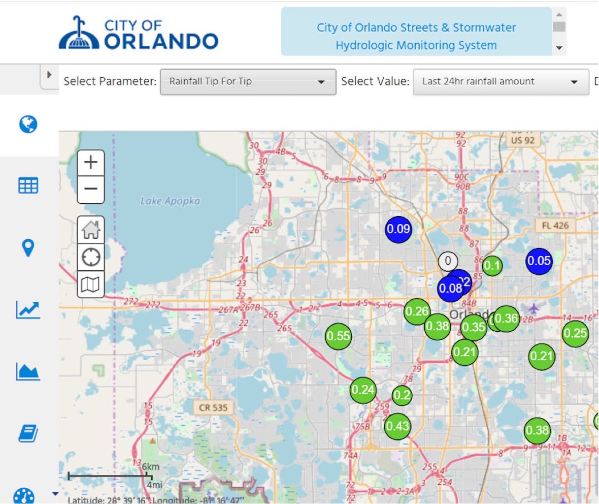
Hensley Henry, AQUARIUS Administrator for the City, who was responsible for setting up and configuring the system said, “In the past, evaluating the impact of these heavy rain events required multiple spreadsheets and hours of manual effort. Now, with the push of a button, the software can create and retrieve customized intensities to evaluate isolated street flooding and protect the city against liability.” The program can calculate derived data in real-time and run rating curves, calculate aggregates, and fill gaps in a matter of seconds. It is also capable of building more sophisticated multi-input time-series models. AQUARIUS pulls historical statistics and can visualize all types of data in different forms, including meteorological data. The data is easily accessible in real-time through an online dashboard for all stakeholders to prioritize and focus their efforts where needed. To broaden the sharing of data, in 2019 the City chose to make rainfall and stage information available to the public through hydrology.orlando.gov.
In the past, evaluating the impact of these heavy rain events required multiple spreadsheets and hours of manual effort. Now, with the push of a button, the software can create and retrieve customized intensities to evaluate isolated street flooding and protect the city against liability


“The new platform has boosted the value of our monitoring operations by making it easy to share data with citizens and actionable to professionals”, said Richard Lee, Stormwater Assistant Division Manager for the City of Orlando. Meaningful context (e.g., lake elevation criteria) and comparisons with historical data, help transform current data into information and provide better insights during episodic events to guide management actions. By utilizing alerts and notifications based on custom levels, the City is proactively forecasting potential problems.
Internally, this means the overall efficiency for the team has improved. “We are able to trust the timely delivery of data, enabling us to be proactive, not reactive, and eliminate ad hoc data requests,” said Lee. Efficiency has improved as the guesswork is removed from field visits. “We now know what to look for and how to respond based on the data. For example, a lot of rain in a certain area is likely to cause street flooding because of debris obstructing storm drains. Reviewing the data allows us to determine if the flooding is caused by an under designed system, or if it is simply an occurrence due to mother nature. For this case, we will dispatch crews to the area before we get customer complaints” concluded Lee.
Flooding can also give rise to water quality issues. The City is in the process of expanding its water quality data management through the same platform which will then give stakeholders and citizens access to things like nutrient levels, bacteria counts and turbidity. At a glance citizens will be able to assess the health of Orlando’s water bodies. Alerts can be set so stakeholders can react to elevated E. coli values and be made aware of nitrogen, phosphorus, and chlorophyll concentrations that exceed the state’s surface water quality standards. Stakeholders will be able to evaluate the system quicker and develop management tools to help improve the water quality.
The City’s team now has time to catch up on important administrative tasks and work on plans to incorporate stormwater flow data into Time-Series. This tool allows the City to centralize vast amounts of hydrologic time series data, discrete measurement data and complex river gauging measurements from various locations. It makes it easy to integrate, import, and enter data quickly, so they can effectively manage all their environmental information on one platform. AQUARIUS has a unique portfolio of features for real-time sanity checking, error detection, data cleaning, and rating shift management.
We now know what to look for and how to respond based on the data. For example, a lot of rain in a certain area is likely to cause street flooding because of debris obstructing storm drains. Reviewing the data allows us to determine if the flooding is caused by an under designed system, or if it is simply an occurrence due to mother nature. For this case, we will dispatch crews to the area before we get customer complaints.
“At some point in the future, we would also like to add contour elevations in order to correlate lake stages with topographic, bathymetric, and basic water quality information for general purposes. Having this information will allow us to set the flooding levels at each location and have a better handle on the stage, area and discharge characteristics for each lake” said Lee.
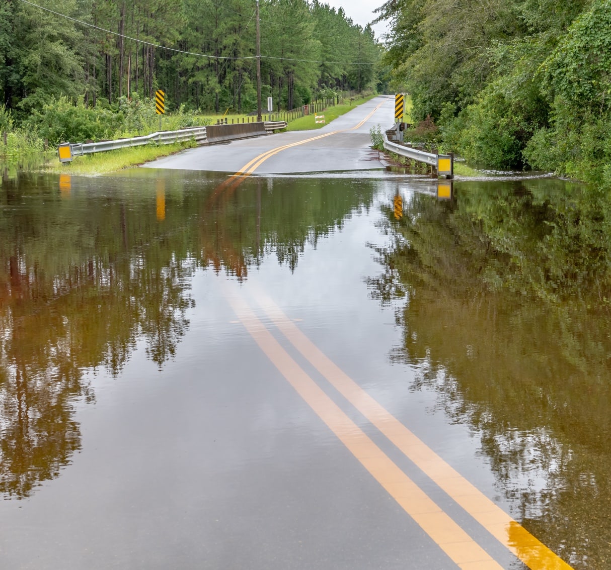
Maintaining and operating the City’s roadways and right-of-ways and ensuring efficient and safe transit on all City streets and pedestrian ways, as well as maintaining and improving the City’s drainage facilities, all falls on the shoulders of the Streets & Stormwater Division. Having timely & accurate information to empower better, faster decision-making helps guarantee public safety and government compliance.